July 24, 2013
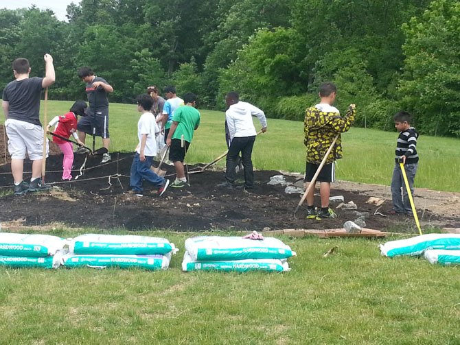
Centreville Elementary fourth-graders work the soil inside their map of Virginia.
Stories this photo appears in:
Local Students Learn by Doing
Centreville Elementary fourth-graders create living map of Virginia.
It’s one thing to tell children about their state — its shape, geography and crops — and another thing to have them re-create it in an interactive scale model. But that’s what happened at Centreville Elementary.
Comments
Use the comment form below to begin a discussion about this content.
Sign in to comment
Or login with:
OpenID