April 16, 2018
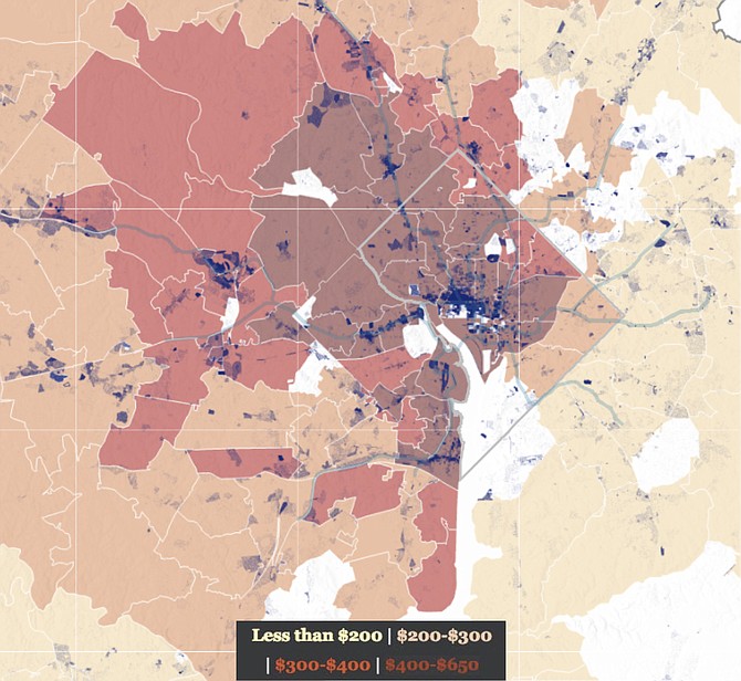
Whereas jobs are concentrated in the metropolitan core, more affordable housing is spread to the metropolitan periphery. Regional transit helps bridge the gap. The color shading represents price per square foot at time of sale. Blue dots represent job densities.
Image created by the Esri Story Map Team (storymaps.arcgis.com) as part of an interactive data-mapping presentation called “End of the Line” (storymaps.esri.com/stories/2017/dc-transit); reproduced with permission. Map data from Zillow (zillow.com/research/data) and the U.S. Census’ Longitudinal Employer-Household Dynamics program (lehd.ces.census.gov).
Stories this photo appears in:
Connecting Jobs and Housing
Major transit decisions likely to have long-term, regional ripple effect.
Comments
Sign in to comment
Or login with:
OpenID